After picking up a car at the airport (named after Madeira’s most famous son, Cristiano Renaldo, with a statue, a museum and a hotel in tribute to him in Funchal), we headed towards Paul do Mar on the southwest coast.
This small village is a surfing hot spot and considered charming with ‘pretty little streets’.
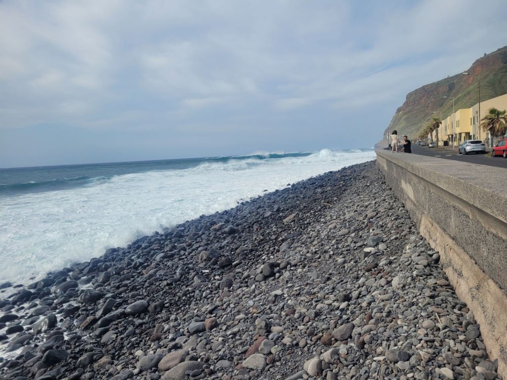
While the waves were impressive, they weren’t huge and the village was charming (sort of) but not particularly pretty.
Well we didn’t think so at any rate.
It was windy (which explains the waves) and after a snack we sought out our next hotel, perched above the village of Calheta.
Calheta has two artificially created beaches (using sand imported from the Sahara), a very short strip of seafront hotels, restaurants and ‘entertainments’ (think bungie jumping) plus a miniscule harbor. Behind the seafront, at the top of the cliffs, is the rest of the village, which we didn’t explore.
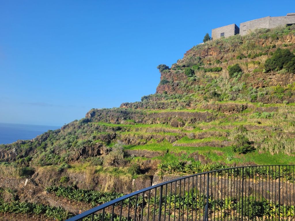
The approach road to our hotel was … steep – understatement of the year: the buildings were perched half-way up the cliff. We bottled entry from the top as the road disappeared from under the front wheels when we came round the corner on to it, choosing instead to go uphill from sea-level. Still steep but not quite as worrying (and we had a clear view of the road all the way up to the car park).


At the top of the cliff, in the outskirts of Calheta proper, a modern art galley provided us with some culture. The building is ultra modern, and has breath-taking views across the sea.
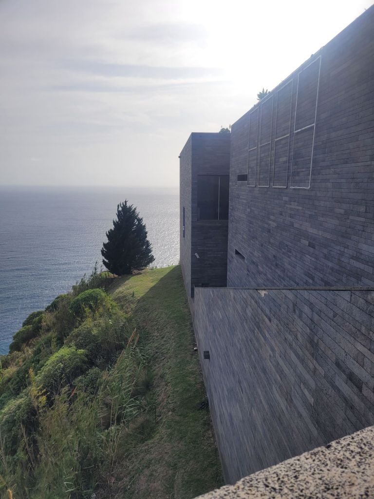
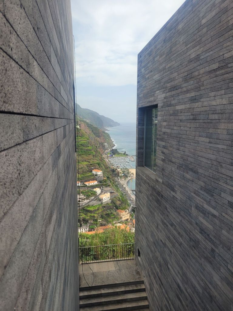
Neither Roger nor I are particularly knowledgeable about art and I personally find most modern art quite baffling (and he doesn’t like most of it). As a result, the walk up to the gallery and around the outside of the buildings took roughly the same amount of time we spent looking at the exhibits. To put this in context, the picture of the museum at the top of the cliff was taken from the hotel terrace – it’s not far but it was steep.
We also took our first levada walk – fortunately on the flat!
Madeira’s levada system is a unique water management system that is recognised by UNESCO as a World Heritage site. The system was started in the 15th century and served to move water from the wetter north to the drier southern part of the island.
Once established on Madeira, the Portuguese planted sugar cane, which became the major source of wealth for the island (in fact, Madeira was the main producer and exporter of sugar to Europe in the second half of the 15th century).
And yes, sugar cane is linked to slavery and yes, early construction of the levadas was carried out by slaves ( and criminals) – lots of workers died. It was incredibly dangerous in places.
And yes once again, it was quite hard to unearth these little factoids, as there is nothing on the UNESCO site or on the main Madeira websites to reference the use of slaves. I had to do some quite specific googling to check my limited knowledge, gleaned from a TV program about Madeira that I watched several years ago.
The result, however, is about 800 Km of channels (not all date from the 15th century!) that remain in use today. Those at higher altitudes channel water for hydroelectricity, while the rest are still used for irrigation.
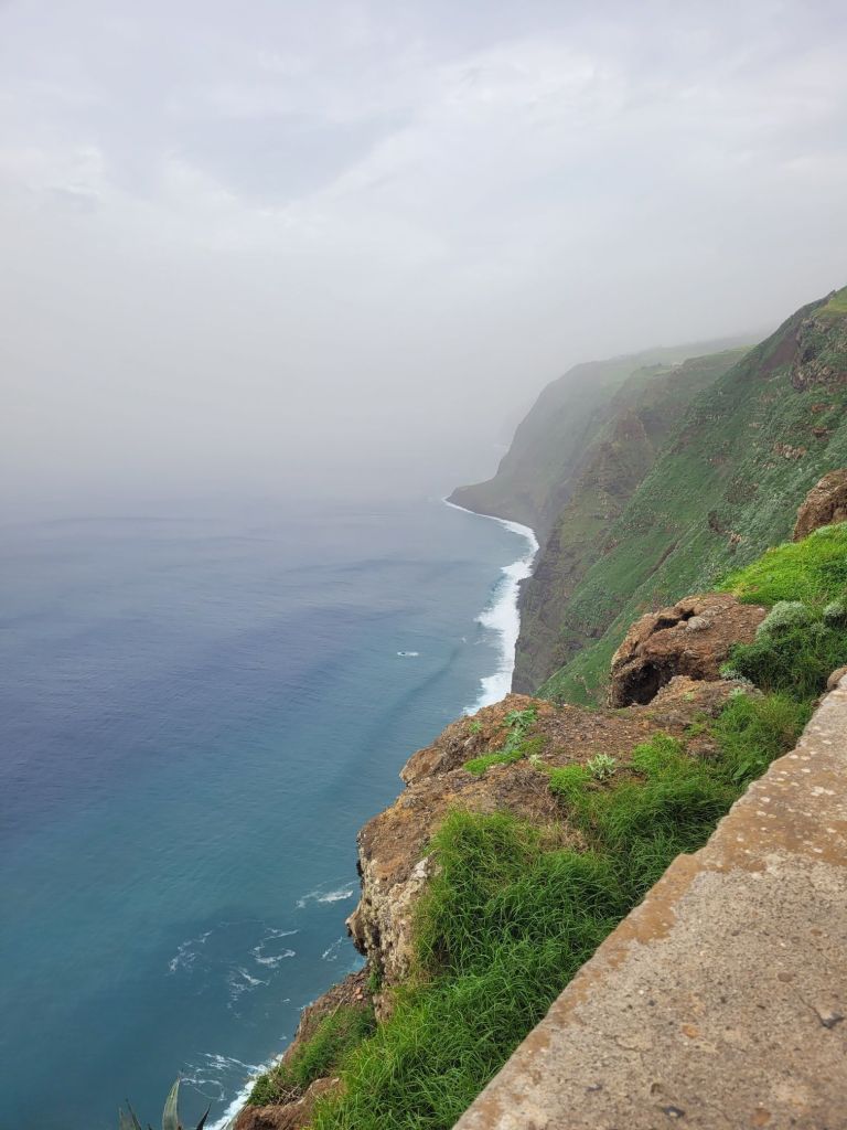
Many of the levadas have paths alongside them and we took a there-and-back walk that ran parallel to the coast.
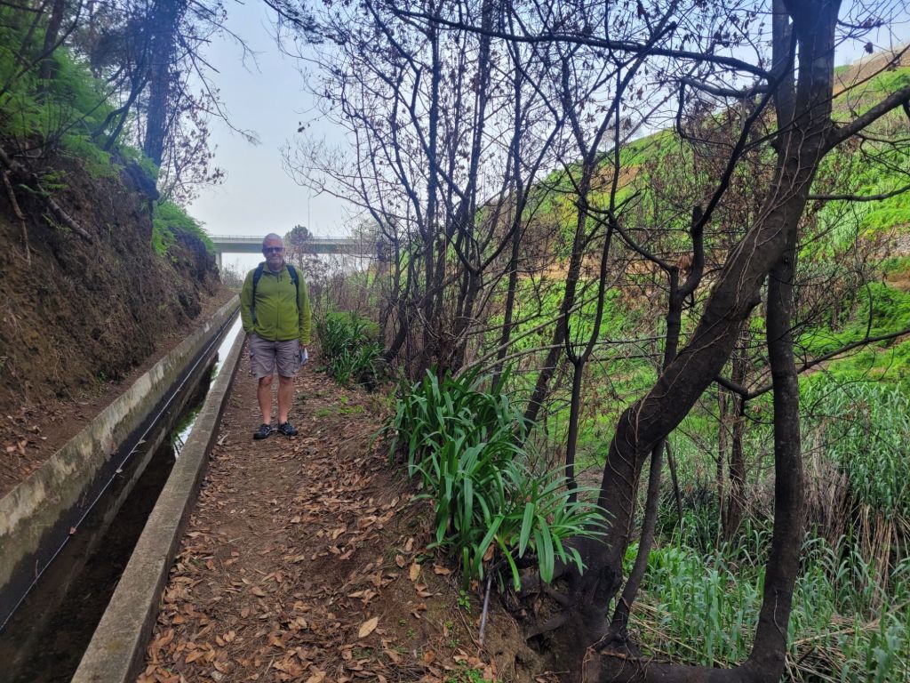
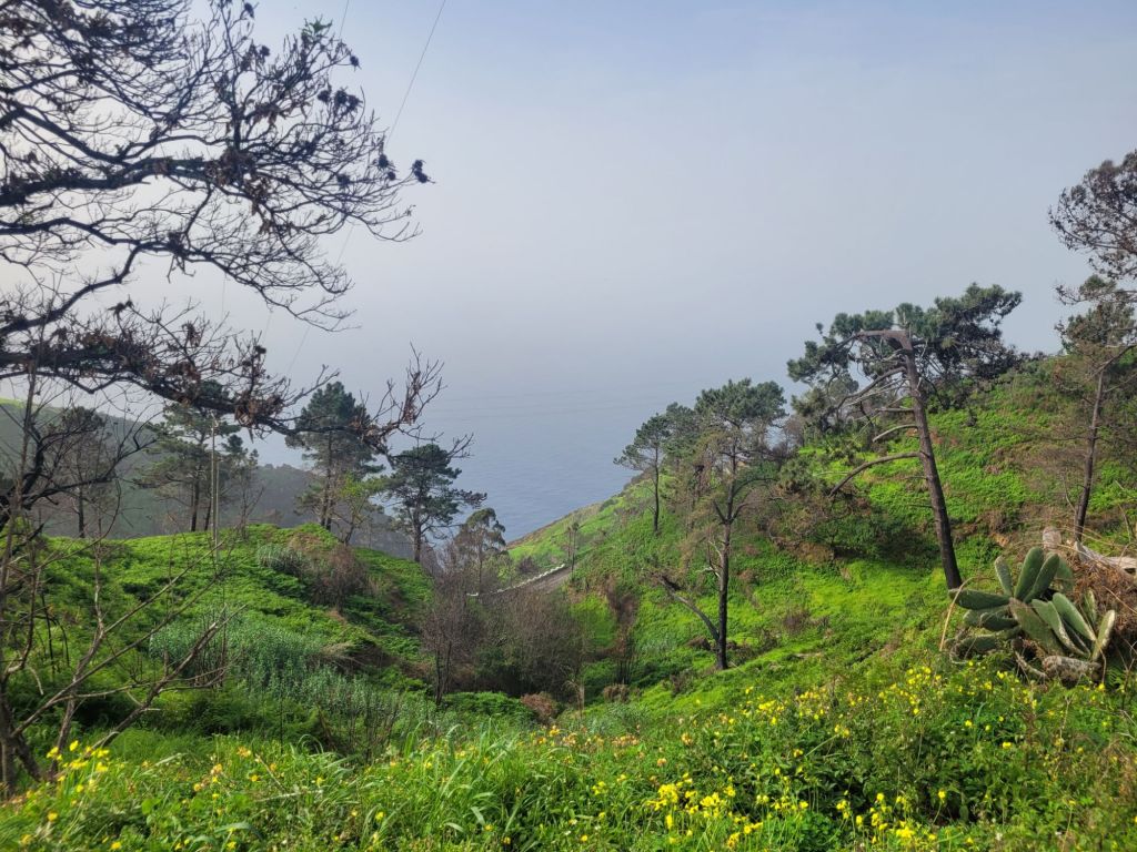
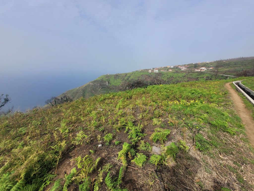

In the interests of honesty, we did drive up to the village where we joined the route. Otherwise, the walk up is steep. But our route was beautiful, easy going and safe. High above the ocean, we had magnificent views, and it was only as we navigated the ravines that it became clear just how far down the water really was.
The safety element is important as it doesn’t always apply to the levada walks: some are narrow, vertiginous and slippery, with no handrails.
As levada novices, discretion played the better part of valour and we chose safe over adventurous.
The ingenious water management features – storage tanks, sudden troughs at the bottom of slopes and little weirs – ensure that the water runs smoothly. We had what can only be called a ‘lively debate’ about how the path sloped gently uphill, and the water also appeared to run uphill. Yes, it’s against the laws of physics, but that’s what it looked like!
Walking for about 10 km built up an appetite for lunch, which we found in a small village on the westernmost point of the island.
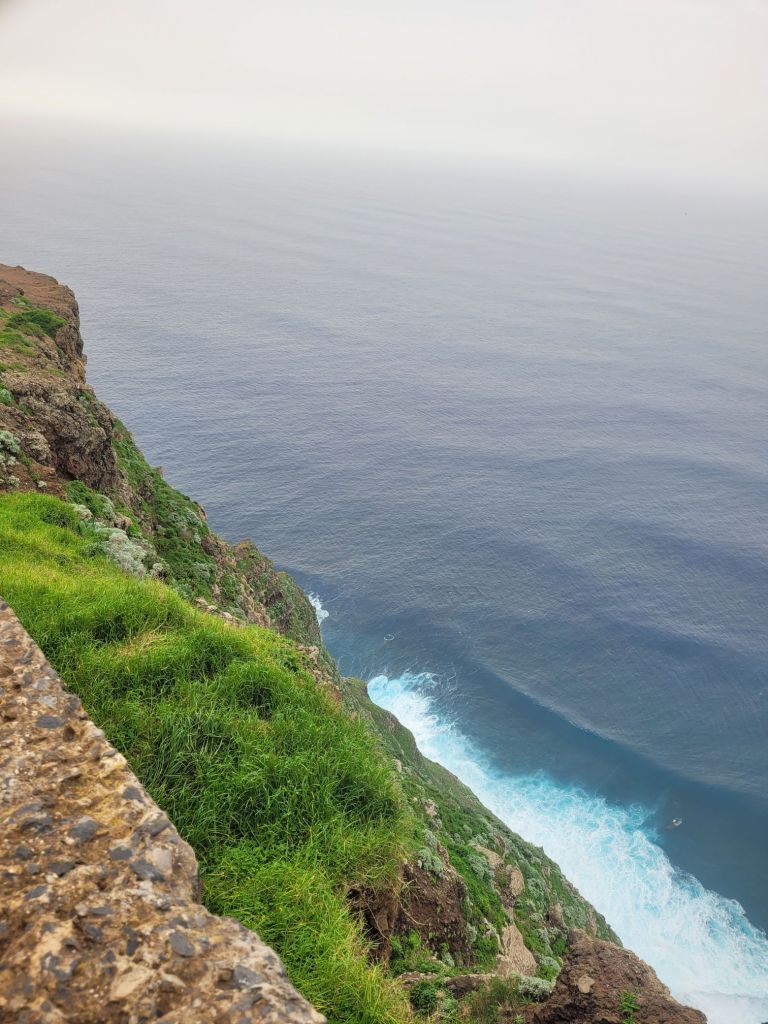
Ponta do Pargo is another small village, generously endowed with bijou coffee roasters (weird) and craft shops. On the coast, just south of the main village, there is a lighthouse with, you guessed it, yet more incredible views of the coast.
The levada we were on would have brought us almost to Ponta do Pargo had we chosen to continue on it, but we couldn’t figure out how to get back to the car from there. The whole transport thing forms a fundamental part of the planning for a levada walk.
Walking the levadas is another of the things that Madeira is famous for and there are all levels of walk and many different types of organised walks. Some are overly popular, some aren’t – we had most of our walk to ourselves. But, again, I found it noteworthy that so little reference is made to the early construction of these channels and those who made them.
And despite looking, I couldn’t find anything that explained how the water appeared to be running uphill!

Leave a comment